
Four coal mines are currently operational in the Special Areas of the Greater Sydney Water Catchment: Dendrobium Mine, Wongawilli Colliery, Russell Vale Colliery, and Metropolitan Mine. These areas are tightly protected, and individuals can attract a $44,000 fine for simply setting foot inside. However, mining companies are permitted to mine beneath these critical areas. Countless historic “legacy” mines have also mined within these Special Areas.
Due to legal restrictions, it is very difficult for members of the public to enter the water catchment special areas, and so citizen science efforts to systematically document impacts of mining on these ecosystems is nearly impossible. The photos below have been taken by citizen scientists over the last decade.
There has media coverage in recent years documenting the damage to catchment areas:
https://www.abc.net.au/news/2019-09-17/longwall-mining-impact-on-drinking-water/11519970
Dendrobium Area 2: 2007: Undermining can cause surface fissures like this to open up across the landscape. These can be up to 15m deep. Parallel lines of these fissures opened up at Dendrobium in Area 2. They extend for hundreds of metres across a slope.
(image: Julie Sheppard)
Dendrobium Area 1: 2008: Massive rocks dislodged from the cliffline tumble down into the valley. (image: Julie Sheppard) 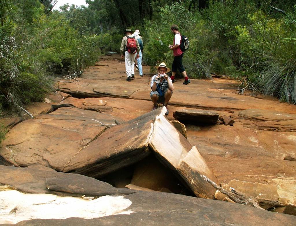
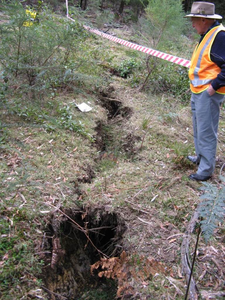
Waratah Rivulet, near Helensburgh: 2006: Here the streambed has cracked and compressive forces have caused upsidence where the creek bed bulges. All surface flow has been lost.
(image: Julie Sheppard)
Waratah Rivulet, near Helensburgh: 2006: Extensive cracking across a rockbar
(image: Julie Sheppard)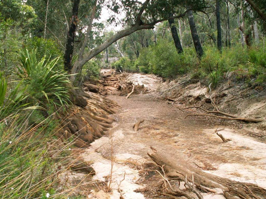
Waratah Rivulet, near Helensburgh: 2006: What was once a beautiful, long, crystal-clear pool has drained like a bathtub once the bedrock underlying the sandy bottom was cracked.
(image: Julie Sheppard)
Waratah Rivulet, near Helensburgh: 2006: Where some water remains, it is highly contaminated with metals such as iron, manganese zinc and nickel. (image: Julie Sheppard) 
Waratah Rivulet, near Helensburgh: 2011: Gas venting due to fractures opening up in the bedrock. This fugitive gas emission is not quantified nor factored into the calculation of greenhouse gas emissions from the mine.
(image: Julie Sheppard)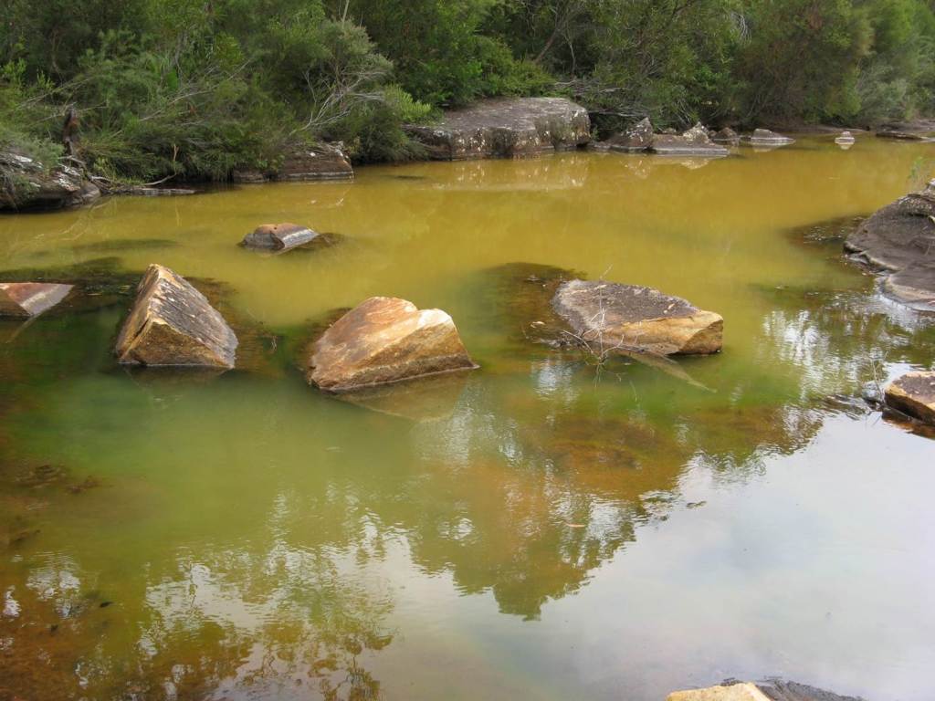
Waratah Rivulet, near Helensburgh: 2011: The state of the water in Waratah Rivulet in 2011, 5 years after the original damage upstream. Contaminated water has re-emerged downstream.
(image: Julie Sheppard)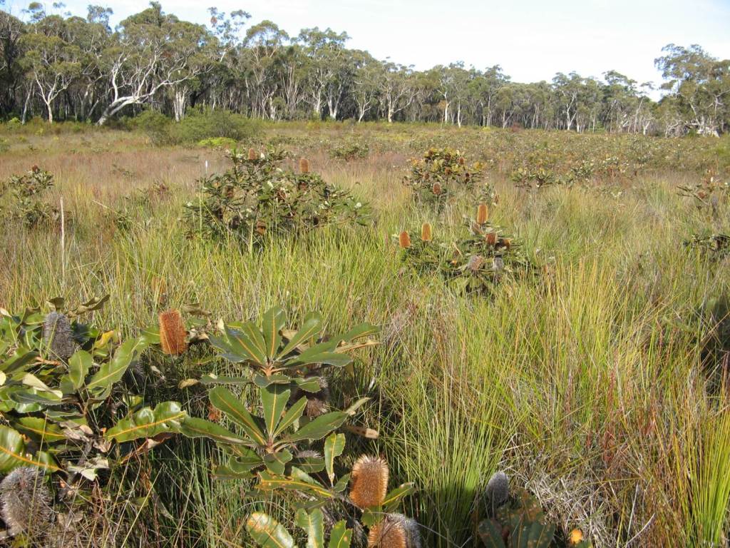
Upland Swamps, Dendrobium lease area: 2012: A healthy upland swamp in the Dendrobium mine lease area. Upland swamps are nature’s “leaky storages”, capturing rainfall and releasing water gradually to the river system for months after rain. This why rivers continue to flow even when there’s been no rain for months.
This swamp has since been undermined.
(image: Julie Sheppard)
Upland Swamps, Dendrobium lease area: 2008: An exposed bedrock section in a swamp, showing cracking due to subsidence.
(image: Julie Sheppard)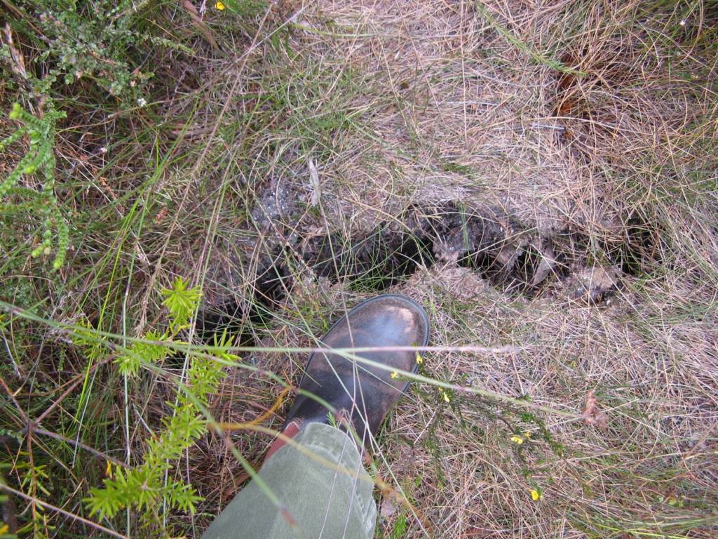
Upland Swamps, Dendrobium lease area: 2008: The cracking extends across the swamp through the sediments which are now bone dry.
(image: Julie Sheppard)
Upland swamps, Dendrobium lease area: 2009: The Banksia robur are the first plants to show signs of stress and then die.
(image: Julie Sheppard)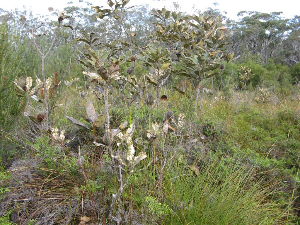
Upland Swamps, Dendrobium lease area: 2013: Highly stressed Banksia roburs in Swamp 15b which is no longer so healthy and lush after undermining.
There is no known method of remediating a cracked swamp.
(image: Julie Sheppard)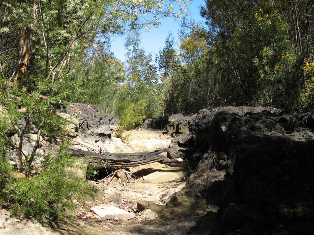
Upland Swamps, Dendrobium lease area: 2007: This shows total swamp collapse. This swamp was undermined in 2003 and then suffered a very intense fire. A healthy swamp will not be destroyed by fire, as only the surface will burn, not the wet sediments and plant roots. A dry swamp is highly vulnerable to fire.
(image: Julie Sheppard)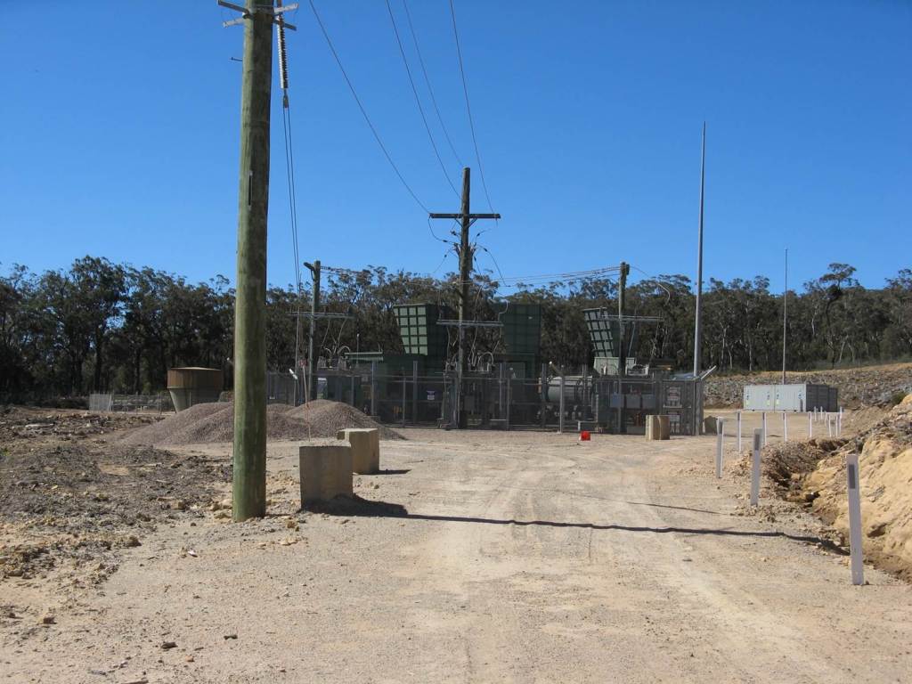
Vent shaft construction, Dendrobium lease area: 2008: Vent shafts have to be built expel stale air and draw in fresh air. To do this in the Special Area requires massive disturbance.
(image: Julie Sheppard)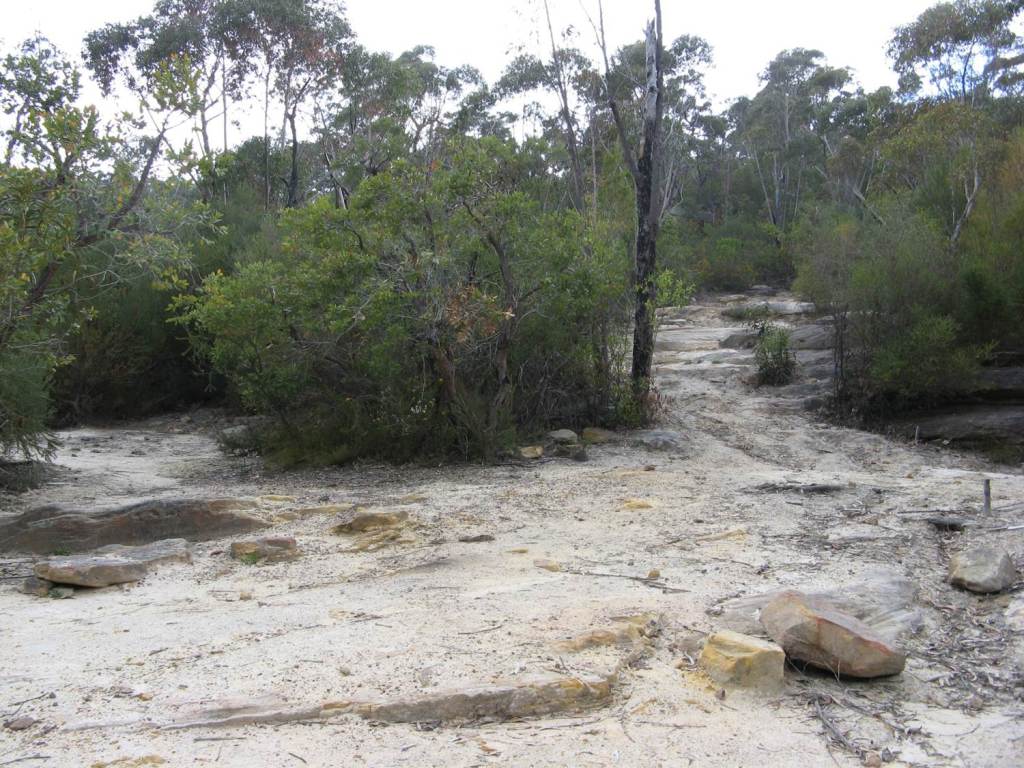
Waratah Rivulet, near Helensburgh: 2012: A cleared wasteland now remains at the worksite for the injection process. This was pristine bushland before.
(image: Julie Sheppard)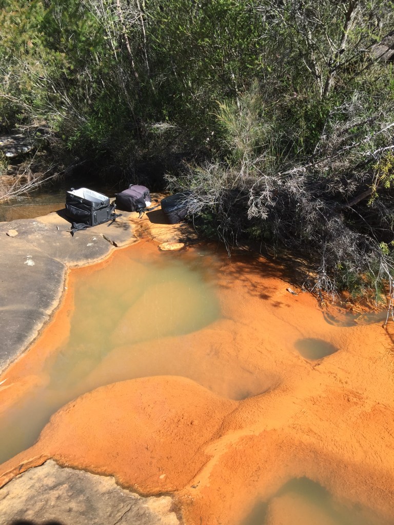
July 2019: Discolouration of Eastern Tributary stream. This stream flows into the Woronora Dam which provides drinking water to the Sutherland Shire and Northern Illawarra. Discolouring is caused by contaminants released from cracking above longwall mines, including iron, manganese, zinc and nickel. Zinc and nickel are very toxic to aquatic life at trace amounts. 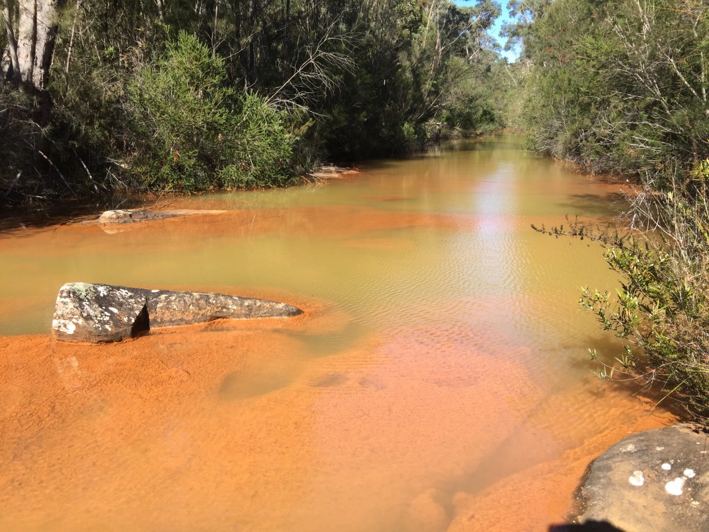
Contaminated stream near Woronora Dam: July 2019: contamination of the Eastern Tributary. This stream flows above a longwall mine and into the Woronora Reservoir. Water is contaminated with iron, manganese, zinc and nickel. Zinc and nickel are toxic at even trace amounts. 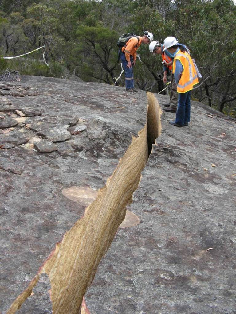
Dendrobium lease area: 2010: Massive rock outcrops like this can split asunder due to subsidence.
(image: Julie Sheppard)
